Subject: Central United States
Period: 1800 (circa)
Publication:
Color: Black & White
Size:
6 x 7.1 inches
15.2 x 18 cm
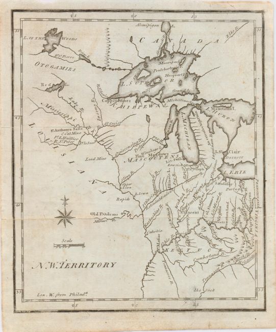
This is the earliest printed map to show the North West Territory. It covers the region of the upper Mississippi Valley and the Great Lakes, and shows the rivers and streams together with settlements, mines and forts. Lit. Fort appears at the mouth of the Chicago River and Old Ft. Orleans appears on the Missouri River. The southern end of Lake Michigan is placed almost a full degree further north than the southern shore of Lake Erie, an error that resulted in a series of boundary disputes between Michigan and its neighbors in the 19th century. The fictitious Charlevoix-Bellin islands appear in Lake Superior. This second state has no geographical changes from the first, only the addition of two small lines to strengthen the tiny circles locating the towns of Detroit, Sandusky, etc.
References: Karpinski (MI) p. 189; Wheat & Brun #674.
Condition: B+
Folding, as issued with light foxing.