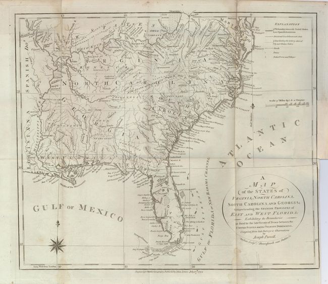
Subject: Southeast United States
Period: 1792 (dated)
Publication: Morse's Geography
Color: Black & White
Size:
14.2 x 12.2 inches
36.1 x 31 cm
A very uncommon map of the early Southeast that shows a well defined New State of Franklin, within the borders of North Carolina. In 1785, settlers in present-day western North Carolina and eastern Tennessee organized a state government to be named in honor of Benjamin Franklin. Congress turned down their appeal but the state maintained a legislature and governor until 1788. This ephemeral state appeared on a small number of maps into the early part of the 19th century. The map shows early settlements, including a Moravian Settlement in North Carolina, and the Cumberland Settlements in present-day Tennessee. The map also notes native tribes and various Bounty Land Grants lands along the upper Mississippi River. Engraved by Taylor, published by John Jones.
References: Howes #M840; cf Sellers & Van Ee #1410; Baynton-Williams (TMC) 72, #5 p. 16.
Condition: B
A dark impression on a sheet with folds as issued and a couple of light stains along folds. The binding trim affects the neatline and leaves 1/16" margin at right. An old repair of a tiny binding tear replaces part of the binding trim about 2.5" long.