Catalog Archive
Auction 122, Lot 21

"Repraesentatio Geographica Itineris Maritimi Navis Victoriae…", Scherer, Heinrich

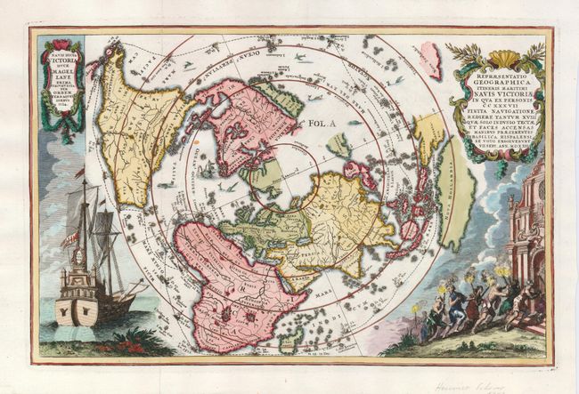
Subject: World - Polar

Period: 1703 (circa)

Publication: Atlas Novus…

Color: Hand Color

Size:
14 x 9 inches
35.6 x 22.9 cm
Download High Resolution Image
(or just click on image to launch the Zoom viewer)

This very graphic map of the world is presented on a north polar projection and depicts all of the world except the South Pole. California is shown as an island and the track of Magellan's voyage around the world is noted. There is a distorted portion of Australia noted as Nova Hollandia. At left is a beautiful engraving of Magellan's ship Victoria, and sea monsters are shown in the oceans. Heinrich Scherer, professor of mathematics at Munich, was a devout Jesuit whose work emphasizes the Catholic hierarchy and the spread of Jesuit missions throughout the world.

References: Shirley #626.

Condition: A+

Estimate: $1,500 - $1,800

Unsold

Closed on 12/5/2007

Archived