Subject: Colonial Mid-Atlantic
Period: 1671 (circa)
Publication: De Nieuwe En Onbekende Wereld
Color: Hand Color
Size:
14 x 11.5 inches
35.6 x 29.2 cm
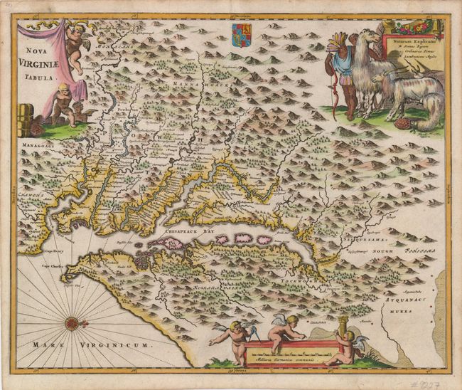
This is a very decorative, carefully made map based on the Hondius/Blaeu version of John Smith's prototype of Virginia and the Chesapeake Bay. It is beautifully engraved with mountains, rivers, and forests and provides a wealth of information concerning the Indian villages in the region. The title and distance scale cartouches feature putti and a scene at upper right features Native Americans with a llama, unicorn and a fat-tailed sheep. This is the first state, printed on paper watermarked with a jester.
References: Burden (II) #412; Tooley (Amer) p.168-9, plt. 76; Goss (NA) #38.
Condition: A
A nice impression on a sound sheet. There is some minor marginal toning, and a nearly invisible damp stain at top left that just encroaches into the border. Still very good.