Subject: World
Period: 1700 (circa)
Publication:
Color: Hand Color
Size:
18.3 x 14.5 inches
46.5 x 36.8 cm
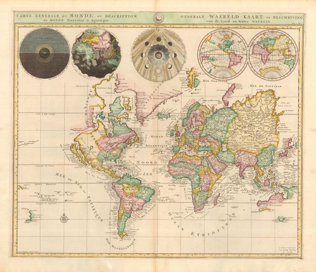
This is the first state of Pierre Mortier's unique world map, drawn on Mercator's projection with California as an island. The Detroit d'Anianis connected by dotted lines through the Northwest Passage to Button's Bay, which is located to the west of Hudson Bay. A small coastline of New Zealand appears in the Pacific. The northeast coast of Asia is severely truncated and shows Witsen's Cap de Glaces. Australia's northern coast is shown connected to New Guinea and only the southern tip of Van Diemen's Land is mapped. A most interesting feature of the map are the five spheres presented at top. These depict Day and Night, the Flood, the phases of the moon, and the Western and Eastern Hemispheres. The map was precisely engraved by Jan van Luchenburg (signature at lower left). This is the first edition with Mortier's imprint.
References: Shirley #622.
Condition: B+
A good-looking map with attractive color and crisp impression. Professionally repaired worm tracks in left and right blank margin, well away from map. Faint toning on the centerfold, otherwise near fine. Hinge remnants on verso.