Subject: United States
Period: 1852 (dated)
Publication:
Color: Hand Color
Size:
60 x 56 inches
152.4 x 142.2 cm
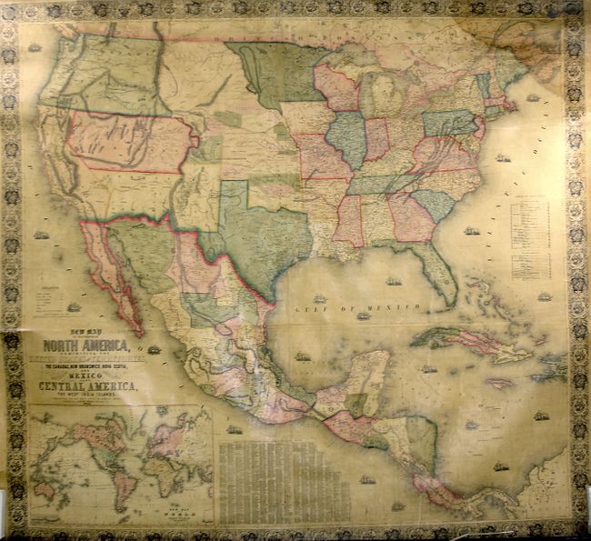
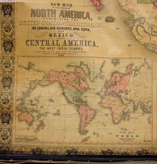
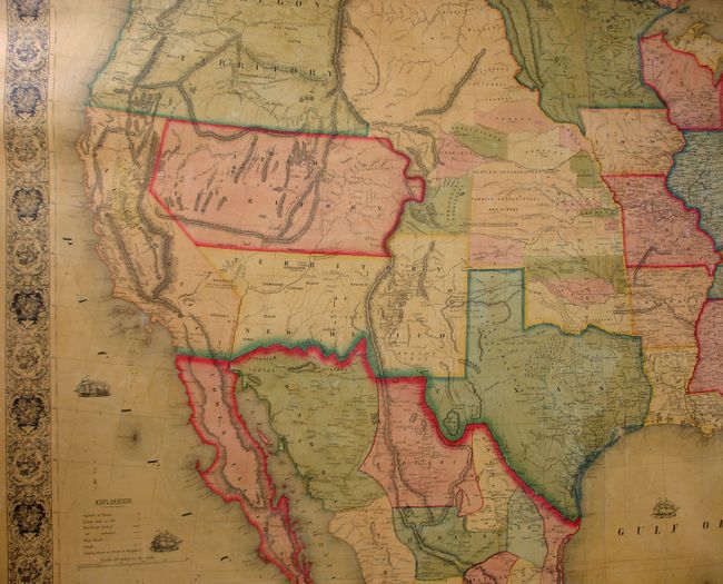
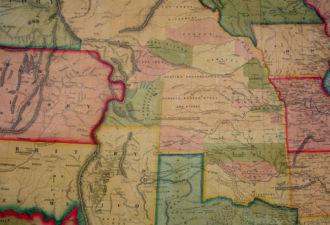
This early and majestic wall map was published just as the country was beginning to expand fully to the Pacific following the land gains from the Mexican War. The gold region in California is quite inaccurate with Auburn shown well north of Sacramento City and lying between it and the Marysville and Yuba City area. The Great Basin roughly follows the Fremont model, and is filled with wagon routes, explorer trails, forts, and Native tribes. Indian Territory is only partially organized by tribe, and extends in a wide swath up to the northern border. A note describes the Hunting Grounds of the Pawnees, Kanzas, Otoes and others. Much of this area is organized into the Proposed Territory of Nebraska in the 1853 issue. Minnesota Territory includes the Dakotas, unnamed at this point. Out west only the new state of California and the territories of Oregon, New Mexico and Utah exist, and the border with Mexico is shown as it was before the Gadsden Purchase of 1853-1854. There are tables of distances, counties and towns listing more than 1,200 names. Large inset of the world on Mercator's projection in the lower left. All references quote the 1853 edition, this being an earlier and perhaps first edition. Complete with both original wooden rollers. A beautiful example of the rarest wall map from Monk's series.
References: Wheat (TMW) #794; Wheat (GOLD) 243; Rumsey 602
Condition: B+
This is a near fine example less a light water stain at the upper right corner and slight insect tracking in lower portion. The varnish has not darkened, rare for this period. The map features original color and linen, but is missing the cloth piping along both edges.