Subject: Colonial North America and Caribbean
Period: 1756 (circa)
Publication:
Color: Hand Color
Size:
19 x 20 inches
48.3 x 50.8 cm
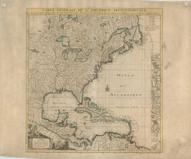
This is the French edition of Popple's key map of 1733, made as an index to his 20-sheet map. This map was initially published separately by Le Rouge in 1742; this edition was made after the Crepy family acquired the plate. The title was changed to reflect the outbreak of the French-Indian War, which occurred in 1756. The map is well-detailed, with excellent representations of topography and waterways, particularly the Mississippi. However, there is a large and spurious lake that is connected to a tributary of the river. The right side of the map is filled with small inset maps of important cities in the Americas, including Boston, New York, Charleston, St. Augustine, Port Royal, Cartagena, and Porto Bello. A decorative cartouche, describing natives and trading occupies the lower left corner.
References: McCorkle #742.2.
Condition: B
A good example that has been backed to repair some tears into the bottom of the map and a missing corner on the lower right blank margin. There are a few stains in the map, mostly confined to the margins.