Subject: Canada - Hudson Bay
Period: 1661 (published)
Publication: Dell Arcano del Mare
Color: Black & White
Size:
18.5 x 28 inches
47 x 71.1 cm
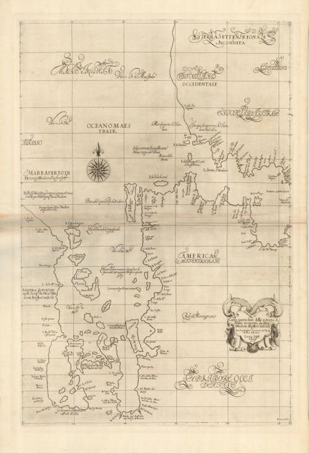
This striking chart of Hudson Bay and Hudson Strait is the first printed sea chart of the region. It is considered a cartographic landmark and would be the foundation for any Canadian collection. The chart is derived from Hessel Gerritz' 1612 map of the region and from the information on Henry Hudson's 1611 explorations. The nomenclature appears to be largely original with many place names descriptive of a particular coastal feature. The Mare Aperto di Henrigo Hudson (Hudson Bay) was believed by Hudson to be the Pacific Ocean. What would become James Bay is shown erroneously with two large bays of its own. The map was beautifully engraved in the sparse Florentine style with superb calligraphy throughout and embellished with a strapwork title cartouche and a bold compass rose. Printed on two joined sheets. Second edition of 1661 with additions in the cartouche.
Robert Dudley was the first Englishman to produce a sea atlas, Dell Arcano del Mare (Secrets of the Sea). This important atlas was the first sea atlas of the whole world; the first to use Mercator's projection throughout; the earliest to show the prevailing winds, currents and magnetic deviation; and the first to expound the advantages of Great Circle Sailing. It contained some of the first detailed sea charts of any part of North America. It was only issued in two editions and the maps are rarely seen on the market.
References: Burden #276; Kershaw #92.
Condition: B+
Sharp impression on very strong paper. There is a little toning on the paper joint and a couple of minor printer's creases, else very good.