Subject: North America
Period: 1834 (dated)
Publication: New Universal Atlas
Color: Hand Color
Size:
10.5 x 12.6 inches
26.7 x 32 cm
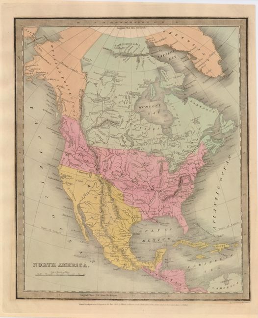
The United States and Great Britain established in 1818 joint claim over the Oregon Territory - the region north of Spanish controlled Upper California up to the southern boundary of Russia's Alaska Territory at North latitude 54°40'. By the late 1830's this arrangement was beginning to fall apart.
In the 1840's the expansionist Democrats, including their 1844 presidential candidate, James Polk, claimed the entire region for the United States. Their expansionist desires were expressed by Polk's famous campaign slogan, "Fifty-four Forty or Fight!" The slogan also became a rally cry for Americans desiring to settle the territory. Following Polk's election, the dispute was resolved by the 1846 Treaty of Oregon, which struck a compromise that fixed the U.S./Canadian boundary at 49º North.
This copper engraved map of the continent has good detail for this style of map. The Rocky Mountains form a single dominant range down the entire continent. The reach of the United State's claims extends well into British Columbia. Mexico still controls the entire Southwest, including Texas. The fictitious L. Timpanago is noted with an amorphous northern coastline.
References:
Condition: A
Lovely original hand coloring on a sheet with some minor toning.