Subject: North America
Period: 1657 (published)
Publication:
Color: Hand Color
Size:
11 x 7.8 inches
27.9 x 19.8 cm
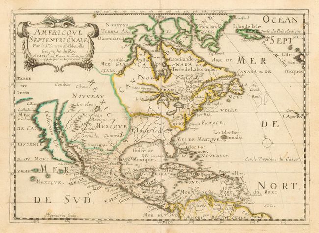
This is a reduced version of Sanson's landmark map of North America [1650]. It shows California as an island with a nearly flat northern coast. All five Great Lakes are shown but are still misshapen and the western shores of Lake Superior and L. des Puans (Lake Michigan) are left open-ended. The Apaches are shown to dominate Nouveau Mexique where the R. de Nort originates in a lake above Santa Fe and flows southwest to the Mar Vermeio. The British colonies of Nouvelle Angleterre and Virginie are confined to the eastern seaboard. This is the first state, engraved by A. Peyrounin.
References: Burden #324; McLaughlin #18.
Condition: B+
Original outline color with some light soil. The map has a little archival tape on the lower margin verso repairing a small centerfold separation.