Catalog Archive
Auction 121, Lot 724

"La Monarchie des Hebreux sous Salomon, ou le Roiaume d'Israel distingue en Douze Prefectures ou Gouvernments", Moullart-Sanson, Pierre
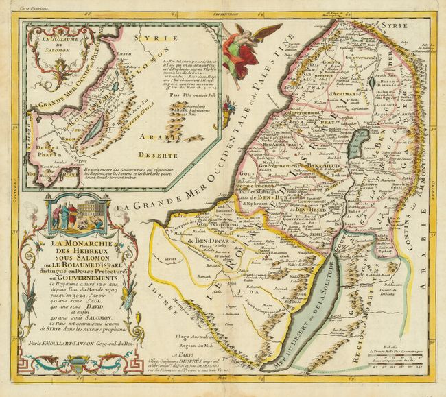
Subject: Holy Land

Period: 1717 (circa)

Publication:

Color: Hand Color

Size:
15.9 x 13.75 inches
40.4 x 34.9 cm
Download High Resolution Image
(or just click on image to launch the Zoom viewer)

This scarce map depicts the Holy Land as it was during the Hebrew monarchy under Salomon, Saul and David. The kingdom of Israel is subdivided into twelve districts including both sides of the Jordan River. The map includes the shoreline from Sidon to Gaza. A large inset shows the Kingdom of Salomon. The map is from a French Bible published by Guillaume Despres. Pierre Moullard was the grandson of Nicolas Sanson. He added the Sanson suffix to his name to publish maps. His business was not successful, therefore his maps are very scarce.

References: Laor #512.

Condition: B+

Sharp impression and attractive old color with faint toning along centerfold.

Estimate: $250 - $300

Sold for: $375

Closed on 9/26/2007

Archived