Catalog Archive
Auction 121, Lot 692

"A New & Accurate Map of Asia, Drawn from the most approved Modern Maps & Charts", Bowen, Thomas
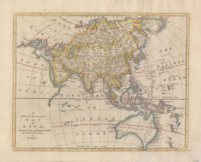
Subject: Asia

Period: 1780 (circa)

Publication: A New and Authentic System of Universal Geography

Color: Hand Color

Size:
15.8 x 12.5 inches
40.1 x 31.8 cm
Download High Resolution Image
(or just click on image to launch the Zoom viewer)

A finely engraved map of Asia and South East Asia filled with information. Hokkaido (Isles de Jesso) is shown as a number of small islands just below the Kuriles, while Japan has an unusual, splayed configuration. Australia is shown with most of the coastline delineated, although a portion near Peter Nuyts Land is shown as a dotted line. Tasmania is shown attached to the continent as Diemen's Ld., which is also the place name shown for the region of present-day Darwin.

References:

Condition: A

A sharp impression on a sheet of fine laid paper, with folds as issued. There are a few insignificant specks in the map.

Estimate: $180 - $230

Sold for: $210

Closed on 9/26/2007

Archived