Catalog Archive
Auction 121, Lot 435

"Magna Britannia Complectens Angliae, Scotiae et Hyberniae Regn. in suas Prov. et Comitat…", Homann Heirs
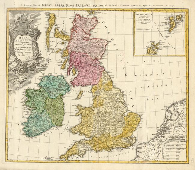
Subject: Britain

Period: 1729 (dated)

Publication:

Color: Hand Color

Size:
22 x 19 inches
55.9 x 48.3 cm
Download High Resolution Image
(or just click on image to launch the Zoom viewer)

This handsome map of the British Isles is filled with details on provinces, towns and counties, with the Orkney Islands included in an inset at upper right. A table at the lower right includes symbols for cities, market towns, bishoprics, roads, ferries and bogs among other places of note. The richly decorated cartouche is topped with the crest of Britain. There is a second title above the map: A General Map of Great Britain and Ireland with Part of Holland, Flanders, France &c Agreeable to Modern History.

References:

Condition: A+

Fine impression and original color with a tiny bit of color offsetting.

Estimate: $425 - $500

Sold for: $375

Closed on 9/26/2007

Archived