Subject: Arctic and Scandanavia
Period: 1597 (circa)
Publication: Geographiae Universae
Color: Black & White
Size:
6.8 x 5 inches
17.3 x 12.7 cm
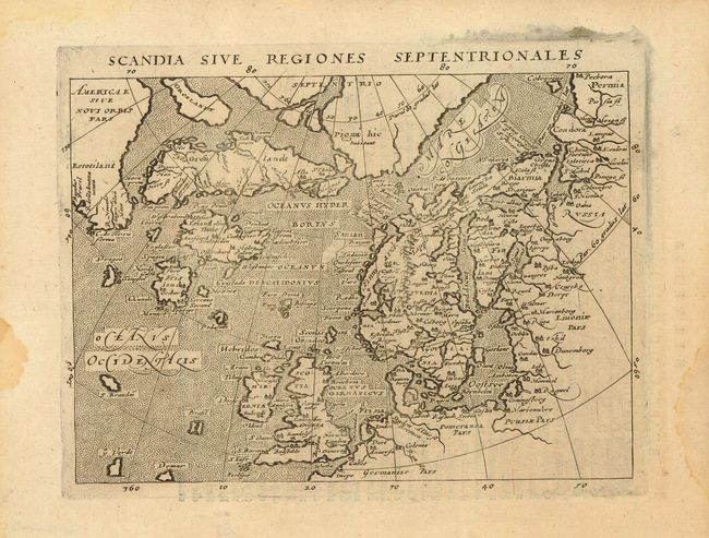
Uncommon, small map based on Ortelius' Septentrionalum of 1570, which in turn was based on the mapping of Nicholas Zeno in 1558. The map shows two Greenlands, one just above the other, as well as the imaginary islands of Frisland and St. Brendain, along with many other small, phantom islands in the North Sea. The North Pole carries a note of Pigmei hic habitant, indicating that pygmies live there. The island of Drogeo shown off the coast of Estotilant is thought to represent Newfoundland. Beautifully engraved with Latin text on verso, from an edition of Geographiae Universae printed in Cologne by Petrus Keschedt.
References: Burden #94.
Condition: A
A little bit of marginal damp staining, not affecting the map.