Subject: Jamaica
Period: 1764 (published)
Publication: La Petit Atlas Maritime
Color: Black & White
A nice set of matching and boldly engraved copper plate maps with good detail.
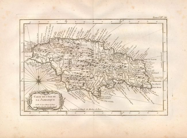
1) Carte de l'Isle de la Jamaique is a very detailed map that describes this island of the Greater Antilles. Divided by parishes, the map shows remarkable detail with scores of place names along the coast plus mountains, personal estates, watershed and other details in the interior. At lower left is a decorative rococo-style title cartouche with compass rose and rhumb lines above. (12.4 x 8"). Scattered foxing. Crisp, dark impression on fine hand laid paper with full, original margins. Grade B+.
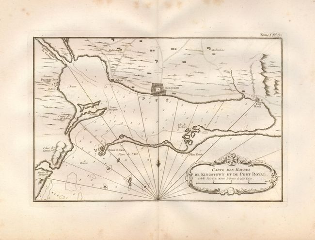
2) Carte des Havres de Kingstown et de Port Royal. Shows Kingston and Port Royal as block city plans, the forts Passage and Rock, roads and habitations, numerous soundings, and more. It is embellished with a rococo-style cartouche, rhumb lines and a fleur-de-lys. (11.8 x 7.8"). Scattered foxing heaviest in upper margin. Crisp, dark impression on fine hand laid paper with full, original margins. Grade B.
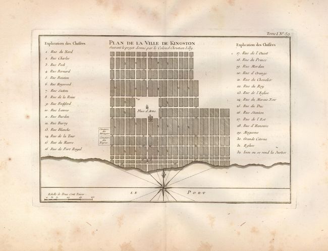
3) Plan de la Ville de Kingston. ( 11.6 x 7.8"). Nice copper engraved plan of the city illustrating the well laid-out streets and avenues numbered, with names keyed at each side. At center is the armory, church and community well. Outside the city limits are the Foreigners' Cemetery and the Blacks' Cemetery. Moderate foxing, mostly in margins. Crisp, dark impression on fine hand laid paper with full, original margins. Grade B.
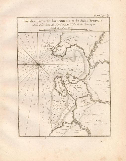
4) Plan des Havres de Port Antonio et de Saint Francois Situes a la Coste du Nord est de l'Isle de la Jamaique. Finely drawn chart of this important eighteenth century harbor on the northeast coast of Jamaica. Depicts fortifications at Port Antonio and on Isle de Lynche and locates many depth soundings and navigational hazards. Embellished with a fleur-de-lys and radiating rhumb lines. (6 x 8"). Scattered foxing. Crisp, dark impression on fine hand laid paper with full, original margins. Grade B+.
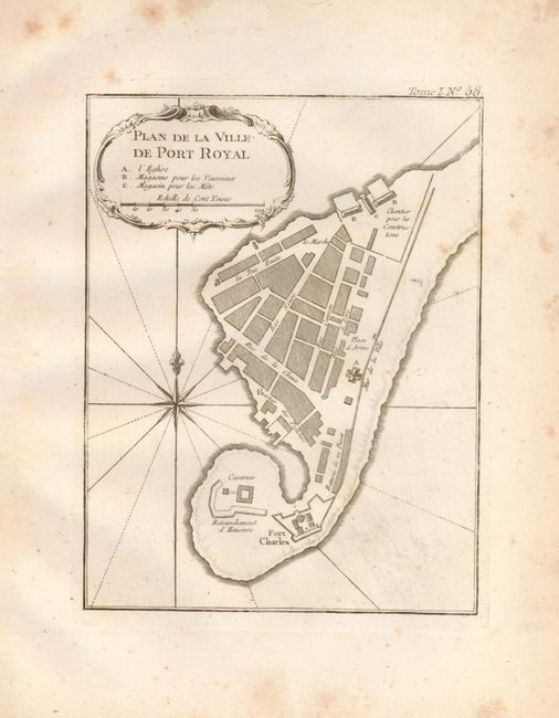
5) Plan de la Ville de Port Royal. Close-up plan of Port Royal with Ft. Charles controlling the entrance. Details include names of individual streets and important buildings. Decorative touches include a rococo-style cartouche, rhumb lines, and a compass rose with a fleur-de-lys. (6 x 8"). Moderate foxing, mostly in margins. Crisp, dark impression on fine hand laid paper with full, original margins. Grade B.
References:
Condition:
See individual descriptions.