Subject: United States & Mexico, Texas
Period: 1848 (published)
Publication: A Memoir of a Tour to Northern Mexico…
Color: Hand Color
Size:
16.3 x 20 inches
41.4 x 50.8 cm
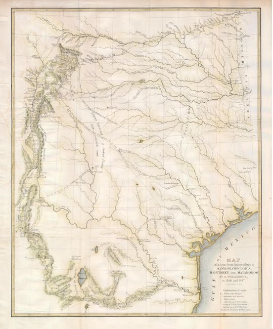
This is a fascinating map of the early state of Texas during the Mexican-American War. Frederick Adolphus Wislizenus, an adventurous doctor from St. Louis, undertook and funded a scientific expedition into Texas, New Mexico and northern Mexico in 1846. When he set out he did not realize that war had just been declared between the United States and Mexico. This map shows his route along the Santa Fe Trail, by the Cimarron route, from Missouri to Santa Fe, then following the Rio Grande south to El Paso, through northern Mexico and ending in Matamoros where he was imprisoned for six months. When freed, he joined Colonel Doniphan’s expedition, providing service as a doctor on the trip home. The map shows the route with a key indicating towns and villages, night camps, haciendas and ranchos, as well as astronomical observations. This map was published in his report, which was included in the Senate Misc. Doc. No. 26, 30th Congress, 1st session. The report and map were the most comprehensive account of the region published during this period.
References: Wheat (TMW) #573.
Condition: B
A nice clear impression on a sheet that has been backed with Japanese tissue. The binding trim on the left has been extended to accommodate framing and the 2" binding tear has been repaired. There are a few faint damp stains in the map.