Subject: Washington
Period: 1857 (dated)
Publication: Senate Doc. No. 11 & HR Doc. No. 2, 1st Session, 35th Congress
Color: Black & White
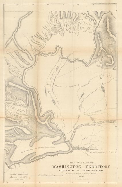
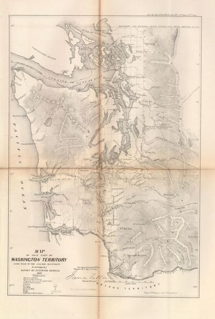
A nice matched pair of early Washington Territory maps. Both signed in the plate by James Tilton, Surveyor General, from the office in Olympia, W.T. The former details the part of the state of Washington from the Columbia River and Ft. Dallas eastward to Ft. Walla-Walla, and north to Ft. Colvill. Also shown are rivers, lakes, roads, the Old Presbyterian Mission, and the Pacific Railroad. Surveyed by James Tilton and lithographed by C.B. Graham, Washington D.C., 1857. (22 x 13.8") Scattered foxing and a few intersectional fold splits. Folding as issued. The latter is a very detailed map of the western third of the state showing early development along the Columbia River and Puget Sound. Also shown are Indian reservations, prairies, swamps, saw mills, flouring mills, roads, trails and lighthouses. Surveyed by James Tilton and lithographed by Wagner & McGuigan, Philadelphia, 1857. (9.2 x 13.4"). A few fold splits repaired with tape on verso. Toned along folds with tiny bit of loss along one fold. Folding as issued.
References:
Condition: B
See individual descriptions.