Subject: Utah
Period: 1871-73 (published)
Publication:
Color:
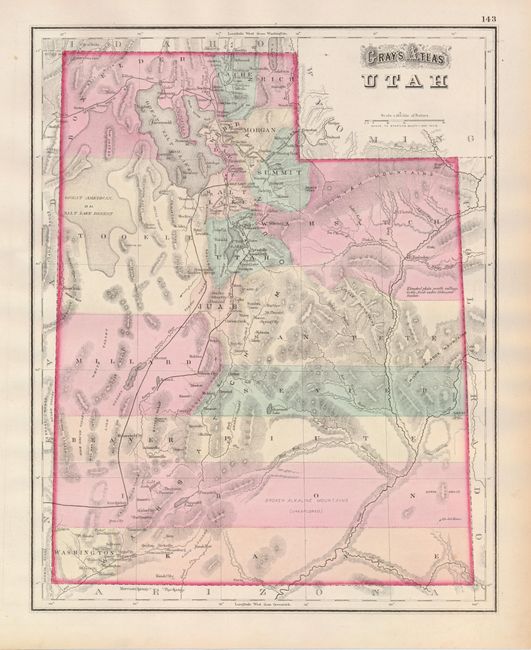
Pair of early maps of Utah. The first, in full original color, shows numerous place names, railroads, towns, forts, and topography. A large area in Iron County shows the Broken Alkaline Mountains as unexplored. Good detail of the Central Pacific railway traversing the territory north of the Great Salt Lake. Locates the forts of Uintah and Ronbedou (Robindoux) in today Uintah County. This fort, located at the junction of the Green and White rivers, was established by Kit Carson as his winter quarters in 1833-34, when it was known as Fort Kit Carson. It is rarely seen on maps. Philadelphia, O.W. Gray, 1873. (11.8 x 14.8"). Near fine with a couple tiny spots in margins. Grade A.
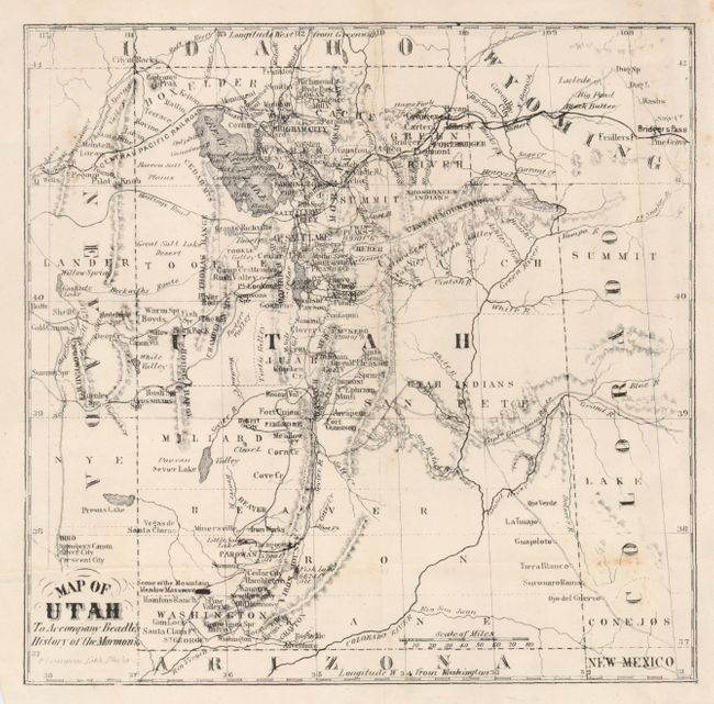
The second map is a small folding map printed by F. Bourguin in Philadelphia, ca. 1871. This uncolored map is filled with place names, forts, roads, railways, and the routes of Gunnison and Beckwith. There is a notation near the title identifying the "Scene of the Mountain Meadow Massacre." (8.3 x 8.3"). Some light scattered foxing. Grade B+.
References:
Condition:
See individual descriptions.