Subject: Texas, Houston
Period: 1915-1945 (circa)
Publication:
Color: Printed Color
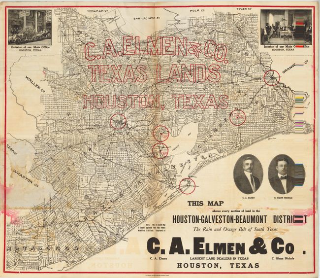
1) This terrific marketing map by C. A. Elmen & Co., Houston claims to show every section of land in the Houston - Galveston - Beaumont District - The Rain and Orange Belt of South Texas. Company name and office locations are shown with red overprinting. There are portraits of the owners, C. Glenn Nichols and C.A. Elmen, and two photographic vignettes in the upper corners show the "Interior of our Main Office Houston, Texas" and "Exterior of our Main Office Houston, Texas." The map was given free to prospective land buyers and notes that "this 10 county map if bought separately from map makers would cost $1.00 each." Red over printed border, blank verso. Printed by Dorsey Printing Company, Houston. A great real estate promotion map for the Texas collector. Measures, 35" x 31", circa 1915.
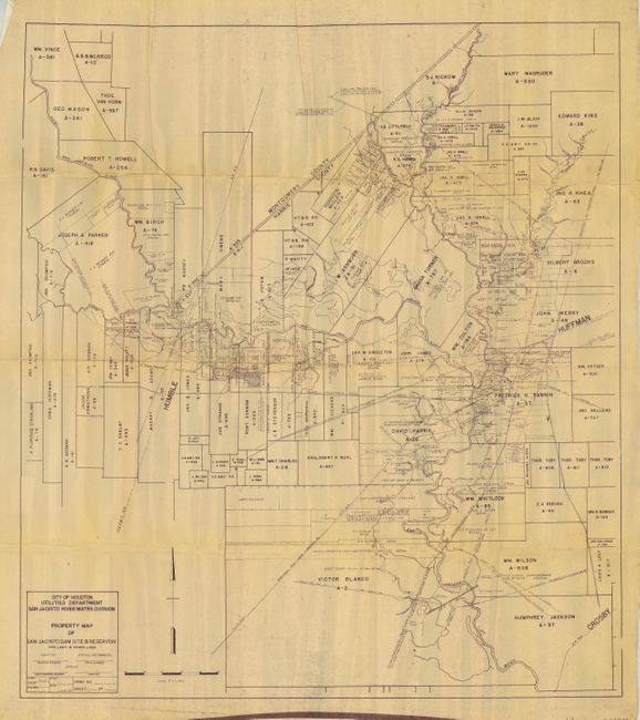
2) This lot includes Property Map of San Jacinto Dam Site & Reservoir, 31" x 35.5", 1945. This is a working blueprint that shows property owners, pipelines, railroads and much more as related to the planned dam. Extremely detailed at a scale of 2" per mile. Names the East and West forks of the San Jacinto River, Caney Creek, Spring Creek, and the Luce Bayou. Completed in 1953, this dam created Lake Houston.
References:
Condition: B
The former has some damp staining with a little running of red ink at both sides, and some extraneous creases. Centerfold toned and with some short tears in vicinity of creases, reinforced on verso. 2) This working map has the appearance of being carried on the job site with numerous misfolds.