Subject: Pennsylvania
Period: 1900 (circa)
Publication:
Color: Printed Color
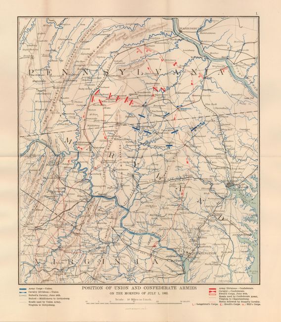
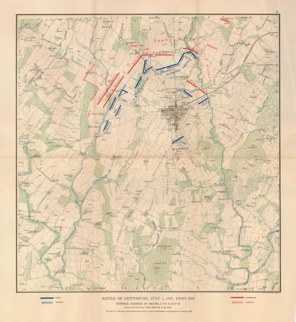
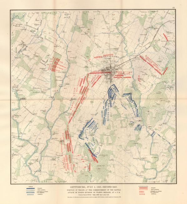
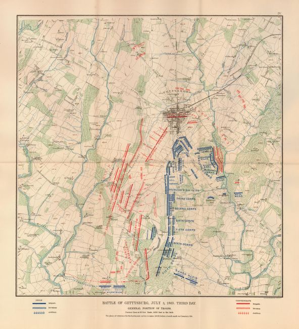
A very interesting set of separately issued maps that show the Union and Confederate Armies' troop build up over three days, from July 1st, to July 3rd, 1863, in Gettysburg. The maps, which show some topography and land ownership, are lithographic prints by Julius Bien and Co. of New York. Position of Union and Confederate Armies on the Morning of July 1, 1863, (10 x 12.5") Shows an expanded view of the area including parts of Pennsylvania, Maryland, and Virginia. The rest of the maps show the immediate area around Gettysburg, and are listed as follows: Battle of Gettysburg, July 1, 1863. First Day. (14 x 14.8"); Gettysburg, July 2,1863. - Second Day. (14 x 14.8"); and Battle of Gettysburg, July 3, 1863. Third Day. (14 x 14.8"). Lithographed by Julius Bien & Co. Lith, N.Y. These maps, apparently from the same plates, were separately issued and are not taken from the Atlas of the Rebellion. No reference located for these maps.
References:
Condition: A+
Maps are clean and bright with just a hint of edge toning. One with a slight misfold in margin.