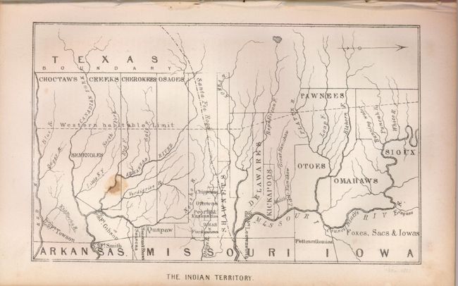
Subject: Oklahoma
Period: 1844 (dated)
Publication: National Review
Color: Black & White
Size:
7.25 x 4.5 inches
18.4 x 11.4 cm
This most uncommon map shows the divisions of lands owned by the various tribes. Covering the area of today's Okalahoma and Kansas, the map locates the lands of the Choctaw, Creek, Cherokee, Osage, Pawnee, Sioux and more. Also shown is the Santa Fe Road, Fort Leavenworth, Fort Smith and the "Western Habitable Limit". Text pages are numbered from 111 to 220, and contain text relating to U.S. Government polices toward Indians, as well as several sonnets and poems. Map is bound into part of the original National Review, Vol. XIV, February 1844, at page 172.
References:
Condition: B
Text is generally good with occasional foxing and some spots. Map has a spot and some marginal toning.