Subject: New York City
Period: 1867 (circa)
Publication:
Color: Hand Color
Size:
22.8 x 12.8 inches
57.9 x 32.5 cm
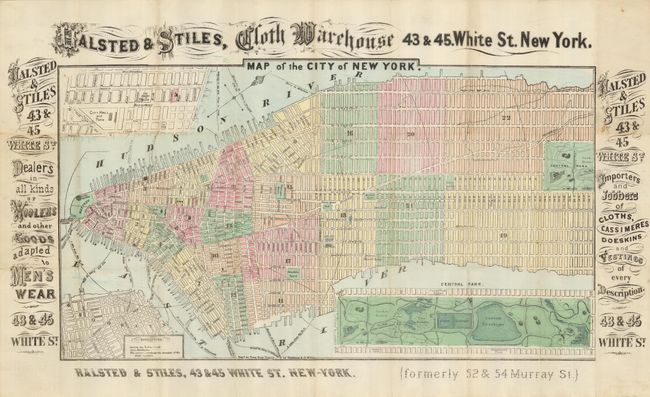
A vibrant and uncommon map of Manhattan from 70th Street south to the Battery, with wide margins filled with advertising for Halsted & Stiles, a cloth and dry goods wholesaler located at 43-45 White St. in what is now the TriBeCa neighborhood in New York. The map also shows Brooklyn, and the ferry routes of that time prior to the building of the Brooklyn Bridge. There are insets of Central Park and lower Broadway near City Hall. Central Park is shown with two Croton Resevoirs; the second smaller one was filled and and made into the Great Lawn in the 1930s. The wards are designated by alternating blocks of hand coloring. Map folds down to 3.5 x 6".
References:
Condition: B+
A nice example for an ephemeral item. Folds as issued and there are some very tiny intersectional separations. The printed margins have a couple minor stains.