Subject: Louisiana
Period: 1760 (circa)
Publication:
Color: Black & White
Size:
8.7 x 7.2 inches
22.1 x 18.3 cm
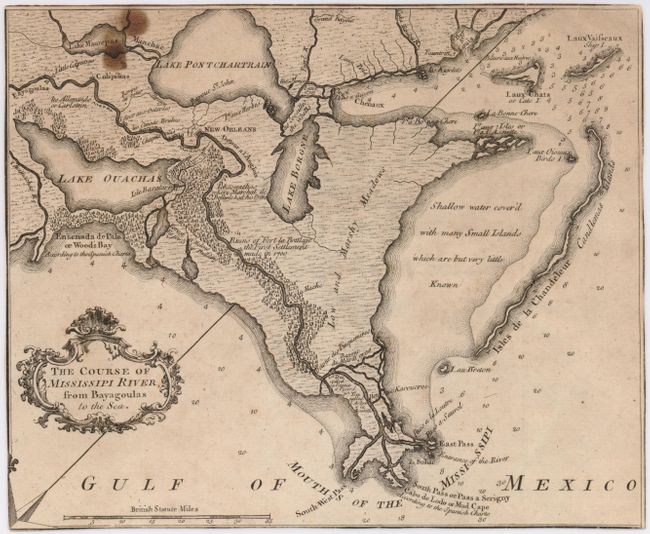
This uncommon map of the Mississippi Delta, with great detail of the river and settlements, was trimmed from a larger sheet map. The map shows the course of the Mississippi from the Bayagoulas village (near the present-day town of Bayou Goula) to Fort la Balise, which defends the entrance and channel of the river. An important feature of this map is the depiction of the Ruins of Fort La Boulaye the First Settlement made in 1700. This fort, located on the eastern bank of the Mississippi River about fifty miles from the Gulf of Mexico, was established by Pierre Le Moyne d'Iberville in 1700 and was abandoned about seven years later. In 1933, the remains of Fort La Boulaye were discovered near Phoenix, Louisiana, in Plaquemines Parish.
References: Sellers & Van Ee #1677.
Condition: C+
Trimmed to neatlines, stain at top left.