Subject: Hawaii
Period: 1897 (dated)
Publication: HR Doc 59th Congress, 2nd. Session
Color: Printed Color
Size:
48.5 x 25 inches
123.2 x 63.5 cm
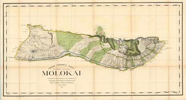
First edition of this large map produced by W.D. Alexander, the Surveyor-General. It is difficult to imagine a more detailed map of the island - topography, watershed, villages, land grants, coastal detail, lava flows, property owners - it's all here. At the turn of the century numerous valleys supported cattle ranches. On the northern exposure can be seen an area of about six square miles dedicated to a leper colony of about 100 souls. It was established in 1866 and was considered one of the most remarkable institutions of its kind in existence. Triangulation by Alexander and M.D. Monsarrat, who also did the boundaries and topography. The map was drawn by F.S. Dodge, C.J. Willis, and S.M. Kanakanui. A fascinating map of this beautiful island.
References:
Condition: B
Folding, as issued, with some offsetting. Several fold splits have been repaired on verso. Some minor toning, mostly along folds.