Catalog Archive
Auction 121, Lot 220

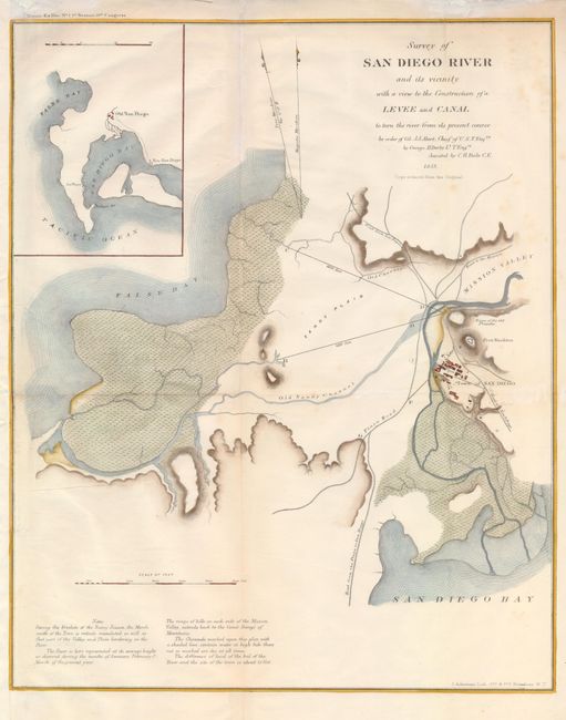
"Survey of the San Diego River and its Vicinity with a View to the Construction of a Levee or Canal to Turn the River from its Present Course", U.S. Government

Subject: California

Period: 1853 (dated)

Publication: Senate Doc. No. 1, 1st Session, 33rd Congress.

Color: Hand Color

Size:
12.5 x 15.5 inches
31.8 x 39.4 cm
Download High Resolution Image
(or just click on image to launch the Zoom viewer)

This attractive map of San Diego is from the survey by Abert and Derby that proposed a diversion of the San Diego River to resolve the problems of flooding during the rainy season. The map is simple, showing the nascent town of San Diego centered around the plaza, with the ruins of the old Presidio and Fort Stockton nearby. The roads are noted and labeled as leading to Los Angeles, as well as New S. Diego. Inset with an overview of the San Diego region.

References:

Condition: B+

There is a little bit of faint foxing. The binding trim in the left margin has been extended to facilitate framing. The central fold has been reinforced on the verso, short tears at upper edge.

Estimate: $190 - $240

Sold for: $140

Closed on 9/26/2007

Archived