Subject: Wisconsin, Minnesota
Period: 1847 (circa)
Publication: Report of a Geological Reconnaissance
Color: Hand Color
Size:
23 x 34 inches
58.4 x 86.4 cm
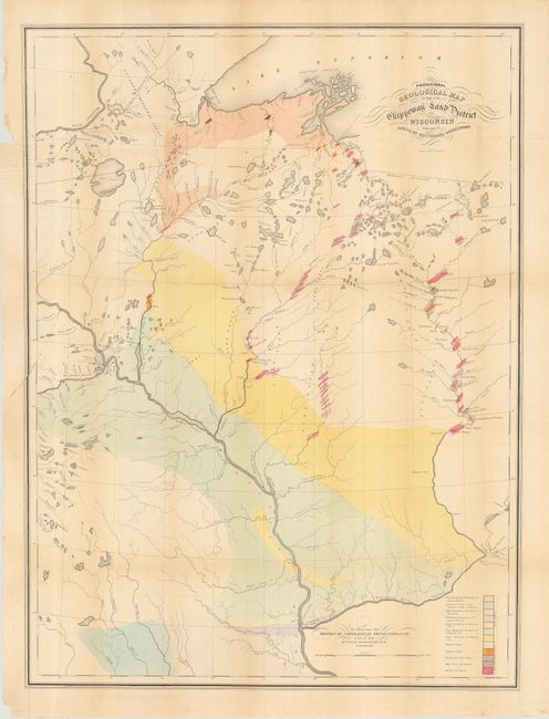
An early geological survey of the area from Prairie du Chien (here also Fort Crawford and Kipy Saging) and north along the Mississippi River to the Minneapolis area and beyond to Duluth. The eastern range includes the rapids along the northern reaches of the Wisconsin River. A legend in the lower right explains the use of color to indicate the twelve different geological formations. This scarce map was prepared to illustrate David D. Owen's report on his geological reconnaissance. Owen and his staff are reported to have worked 12-15 hours every day during the summer and winter of 1847 for this notable survey.
References:
Condition: B
Issued folding, now pressed and backed with tissue. Creasing at left margin from pressing. A 3" tear at left with small chip in margin. A little toned mostly in upper margin and on one fold.