Subject: Colonial Southeast
Period: 1776 (dated)
Publication: Atlas Universel
Color: Hand Color
Size:
22.5 x 19 inches
57.2 x 48.3 cm
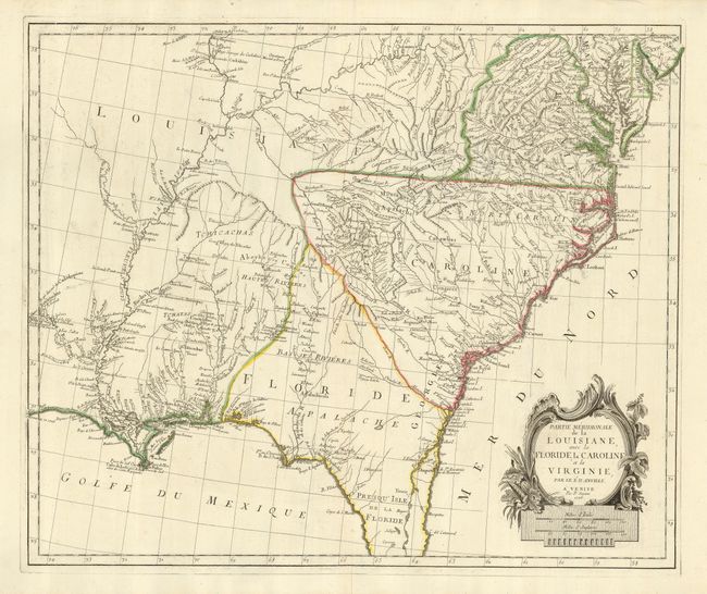
This is a fascinating Italian version of D'Anville's map of the Southeast. It is most notable for the incorrect boundaries showing a huge Louisiana extending eastward to include present-day Kentucky, Mississippi, Alabama and western Virginia. The boundary between the Carolinas and Florida is show at the Alatamaha ou George R. Georgia is not delineated but is named along the coastline. In modern-day Texas is the note of Presidio Espagnol de la Prov. De Tecas. The map is filled with good detail of towns and cities, Indian villages and tribes, rivers, portages, forts, harbors and early place names.
References: Phillips (A) #647-48; Sellers and Van Ee #1408.
Condition: A
Clean bright impression on a sturdy sheet with original outline color. The upper margin has a few tiny wormholes, stopping just shy of the map. There is one tiny rust spot off the coast of New Orleans.