Catalog Archive
Auction 121, Lot 185

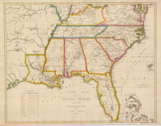
"Southern Section of the United States including Florida &c.", Melish, John

Subject: United States - Southern

Period: 1816 (dated)

Publication: Atlas til friherre Klickowstroms bref om de Forente Staterne

Color: Hand Color

Size:
19.8 x 15.8 inches
50.3 x 40.1 cm
Download High Resolution Image
(or just click on image to launch the Zoom viewer)

A rarely seen map from the Swedish atlas produced by A.L. Klinckowstrom and published circa 1824, based on John Melish's map of 1816. The area shown covers the Southern part of the United State from the Missouri Territory, including most of Virginia and the southern tips of Illinois, Indiana and Ohio. The Bahama Islands are detailed, with one of the islands noted as the Center of the World. It notes the Gulf Stream, roads, forts, and settlements in Missouri Territory. The populations of the states, territories and the Bahama islands are noted in an inset at the lower left.

References: Phillips (A) 1375-15.

Condition: A

A bit of faint offsetting, else fine.

Estimate: $800 - $900

Sold for: $1,300

Closed on 9/26/2007

Archived