Subject: Colonial South
Period: 1732 (circa)
Publication: Atlas Minor
Color: Hand Color
Size:
10.8 x 8 inches
27.4 x 20.3 cm
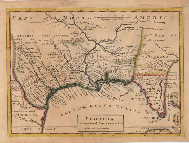
This map is based on Moll's larger map of 1720 and portrays the Gulf Coast and Florida with detail of Indian villages, missions, mines and forts. It is one of the earliest printed maps to describe the roads and trading paths in the region. It is also filled with interesting notations including notes on La Salle's landing in Texas in 1685, the Cenis Missions and early Texas settlements of Teyas and Nachitoches in 1716-17, and the limits of King Charles II's Grant to the Lord Proprietors (Carolina) in 1663. This is the second state with the addition of Georgia and the correction of the title.
References: Cumming (SE) #201.
Condition: B
Toned with some marginal foxing and a paper repair to a small tear just touching the border. A small puncture just south of the Appalachians has been repaired with tissue on the verso.