Subject: Colonial Mid-Atlantic
Period: 1631 (published)
Publication: Atlas Minor
Color: Hand Color
Size:
7.5 x 5.2 inches
19.1 x 13.2 cm
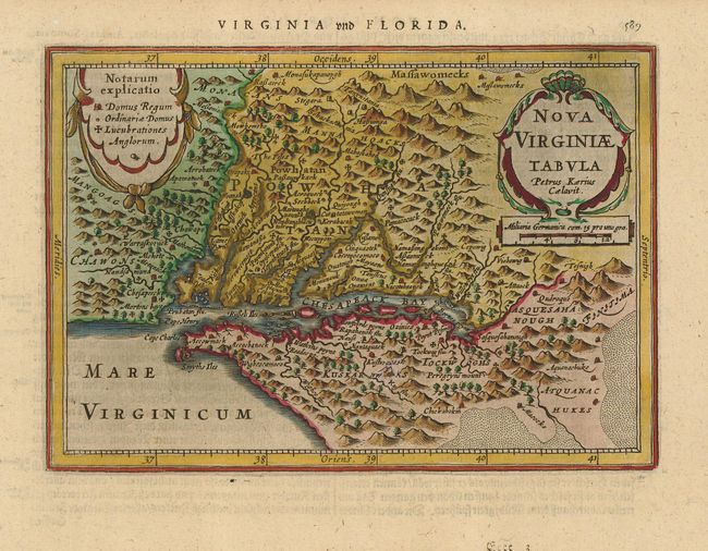
This delicately engraved map is a reduced version of John Smith's map of the Chesapeake Bay region. It is the only regional map of North America to appear in the Atlas Minor. Despite its small size, it is filled with towns with both English and Native names, including Jamestown (Iamestowne), and a key to the types of buildings on the left and pictorial topography. Engraved by Pieter van den Keere with his Latinized name appearing in the title cartouche. German text on verso.
References: Burden #223.
Condition: A
Near fine save for a small imperfection in the map south of Chesapeake Bay about the size of a pencil eraser that has been professionally repaired with a couple of lines of expert facsimile. The repair is imperceptible except on verso.