Subject: United States - Eastern
Period: 1819 (dated)
Publication:
Color: Hand Color
Size:
17.3 x 13 inches
43.9 x 33 cm
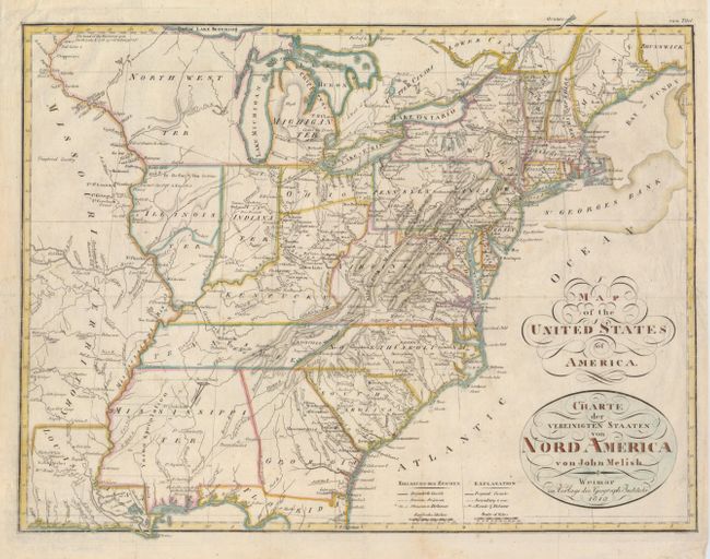
This is an uncommon German issue of Melish's important map of 1813, showing the extent of the United States past the Mississippi River to the large Missouri Territory. The map is filled with early roads, settlements, forts, native villages and towns. The early territories of Michigan, Illinois, Indiana are noted as well as the North West Ter. which takes in the area that would become Wisconsin and Minnesota. A notation of Yazoo Speculation in the oversized Mississippi Territory refers to the Yazoo Land Fraud perpetrated in 1789-1796 when the region was part of Georgia. Three companies bribed and intimidated a bill through the Georgia assembly that allowed them to purchase millions of acres of land for next to nothing, resulting in a huge public outcry. The bill's supporters were swiftly voted out of power, and Senator James Jackson took office. He vowed to repeal the Yazoo Act if it cost him his life, saying he would repeal it even if he had to shoot everyone involved in passing it. He didn't have to shoot anyone, and the law was rescinded in 1796.
References:
Condition: B+
A strong impression with a little scattered foxing and some minor creases. The right and left margins have some chipping and tear at right have been reinforced with archival tape on the verso. Issued folding, now pressed.