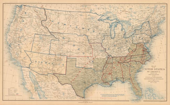
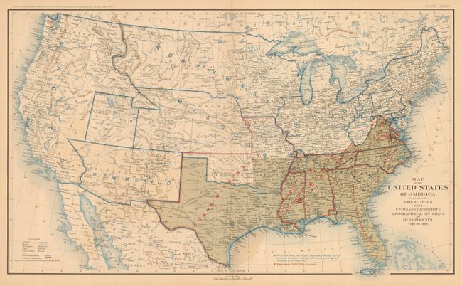
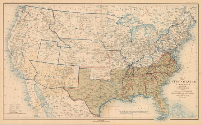
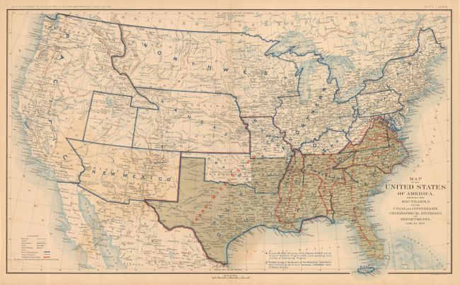
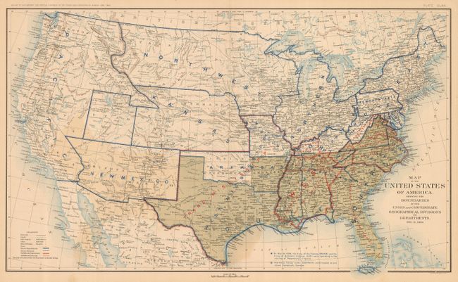
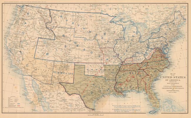
Subject: United States
Period: 1891-95 (published)
Publication: Atlas to Accompany the Official Records of the Union and Confederate Armies
Color: Black & White
Size:
27.7 x 16.5 inches
70.4 x 41.9 cm
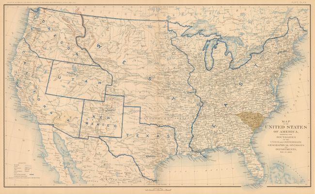
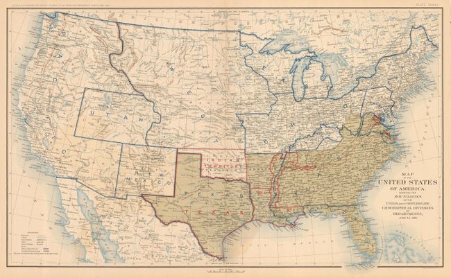
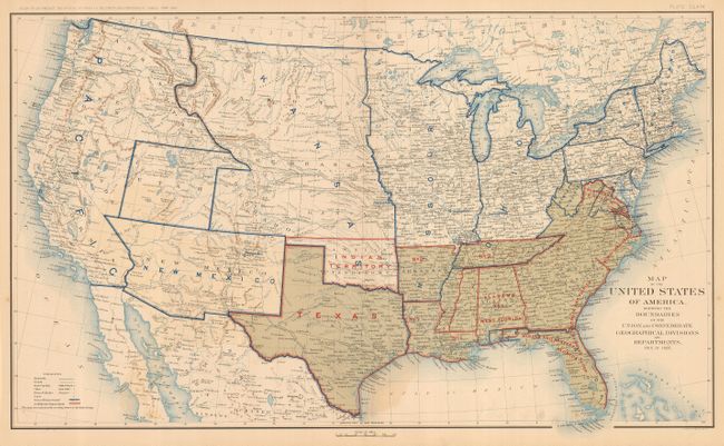
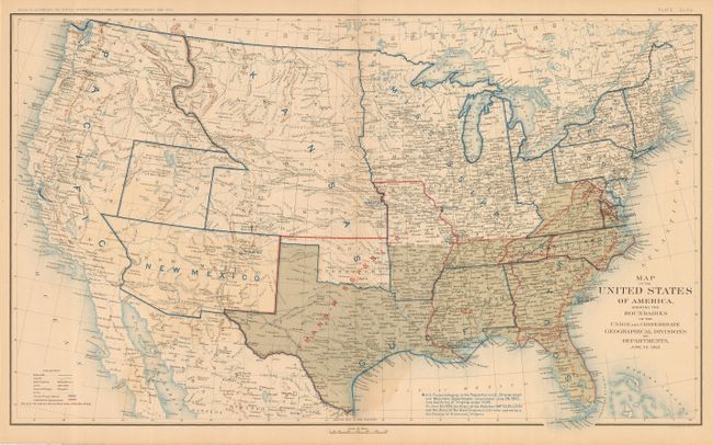
This interesting and historical set of Civil War maps is rarely offered together. The first map is dated Dec. 31, 1860 and shows South Carolina as the only state to secede. Details in the West include the location of Army posts, routes of early explorers, U.S. mail routes, the Santa Fe Trail, Pony Express Route, etc. Succeeding maps reflect changes each six months in Department Boundaries, status of Confederate States, territorial boundary changes, and notations regarding the operations of Union Army forces. This represents the complete collection of maps as published with the last map dated April 9, 1865. The collection includes the dates Dec. 31, 1860; June 30, 1861; Dec. 31, 1861; June 30, 1862; Dec. 31, 1862; June 30, 1863; Dec. 31, 1863; June 30, 1864; Dec. 31, 1864; and April 9, 1865.
References:
Condition: B+
All with crisp impressions, fine color and original margins. An occasional ghost of offsetting or an tiny amount of foxing.