Subject: United States
Period: 1860 (circa)
Publication:
Color: Hand Color
Size:
19.8 x 13.2 inches
50.3 x 33.5 cm
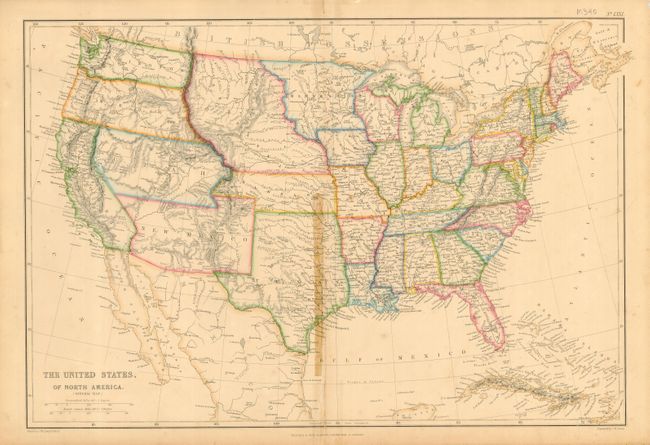
Very precisely engraved map with remarkable territorial boundaries. A large Texas includes today's Oklahoma. Oregon and Washington extend to the Continental Divide. Utah includes present-day Nevada and much of Colorado. New Mexico Territory includes Arizona, the Las Vegas area and a portion of southern Colorado. A huge Nebraska Territory fills the region between the Rocky Mountains and an enlarged Minnesota. Kansas extends the eastern boundary of Utah. A interesting map filled with place names, forts, watershed and topographical information.
References:
Condition: C+
Centerfold has some staining from an old tape repair. Several edge separations repaired with tape on verso.