Subject: Canada and Alaska
Period: 1850 (circa)
Publication: Illustrated Atlas and Modern History of the World
Color: Hand Color
Size:
13 x 10 inches
33 x 25.4 cm
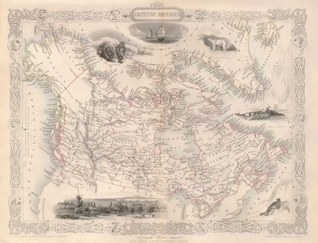
Fine, decorative map is surrounded in a delicately engraved border and further embellished with six vignettes. The area mapped extends to show all of today's Canada and Alaska, here called Russian America. In Canada, at least 23 provinces are delineated through outline coloring. Dots indicate the numerous forts and principal stations of the Hudson's Bay Company. This edition includes a birds-eye view of Montreal, a seal, whale fishing, Esquimaux, polar bears, and a nautical scene showing the ships Fury and Hecla. The illustrations are by H. Warren and engraved by R. Wallis; the map is drawn and engraved by J. Rapkin.
References:
Condition: B+
Nice impression with original outline color. The centerfold is lightly toned.