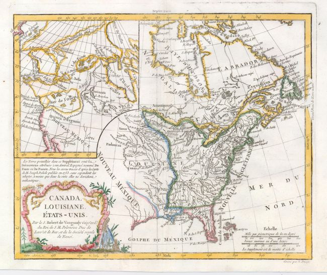
Subject: Canada & United States
Period: 1782 (circa)
Publication:
Color: Hand Color
Size:
11.3 x 9.3 inches
28.7 x 23.6 cm
This is a rare, unrecorded state of this map that first appeared in 1762. The title has been amended to acknowledge the new United States, but it does not have the imprint of Delamarche, which places it between the second (1778) and third (1795) states of the map. A large inset map covers the west coast and is most notable for its depiction of two remarkable cartographic misconceptions; a huge Mer de l' Ouest or Sea of the West and a Northwest Passage through a system of rivers and lakes connecting Hudson Bay with the Pacific based on the fictitious discoveries of Admiral de Font.
References: McCorkle, #762-3; Pedley, #449.
Condition: A+
Centerfold reinforced on the verso.