Subject: Canada, Quebec
Period: 1813 (published)
Publication: Military and Topographical Atlas
Color: Hand Color
Size:
20 x 15 inches
50.8 x 38.1 cm
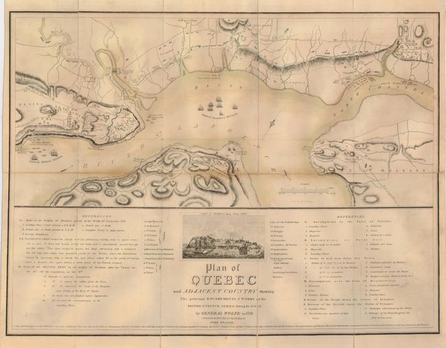
An engrossing and uncommon map of Québec based on a manuscript map made by J. B. Glegg during the Siege of Quebec , which ended the French and Indian Wars. In June 1759, the British Major-General James Wolfe and a massive army travelled to Québec with the plan of defeating the French. Unable to overcome Quebec 's garrison, steep cliffs, and generally excellent defenses, Wolfe laid siege to and bombarded Quebec for two months, accomplishing little more than destruction. On the verge of withdrawal, the British noticed a small cove just west of the city walls. Wolfe and a large contingent of troops landed quietly there in the darkness of the early morning of September 13th, 1759. They scaled the cliffs and advanced to the Plains of Abraham. The Marquis de Montcalm, the French commander, left a defensive position just outside the city and fought them with a matched army of French, Canadians, and Native Americans. The British defeated the French forces after a brief battle, and Quebec surrendered shortly thereafter. Both Montcalm and Wolfe were mortally wounded, but Wolfe lived long enough to know he had won. The map shows details of the troop placements and locations of camps, fortifications and artillery.
References: Phillips (Atlases) #1346.
Condition: B
Issued folding, now laid on fine linen with reinforced folds, some toning on a few folds and a couple small intersectional areas of loss.