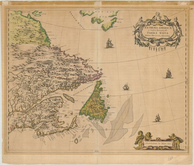
Subject: Canada
Period: 1662 (circa)
Publication: Atlas maior sive Geographia
Color: Hand Color
Size:
22.2 x 17.6 inches
56.4 x 44.7 cm
This is a handsome of the Canadian Maritimes based on Samuel de Champlain's great map of 1632 and augmented with place names from De Laet and Jansson. Blaeu's version shows Nova Scotia, Newfoundland, the Gulf of St. Lawrence, Labrador and the Davis and Hudson Straits as well as the southern tip of Greenland and a portion of northern Maine. The elaborate cartouches symbolize the importance of the Grand Banks fisheries, which are boldly engraved on the map.
References: Burden #371; Goss (Blaeu) p. 158; Kershaw #149.
Condition: C+
A nice impression with faded original color and gold highlights. The paper in the margin is mat-burned, and there is some tape residue at the top margin. Centerfold reinforced on verso with brown paper tape.