Subject: Colonial United States and Canada
Period: 1777 (dated)
Publication: Atlas Ameriquain Septentrional…
Color: Hand Color
Size:
19.5 x 24 inches
49.5 x 61 cm
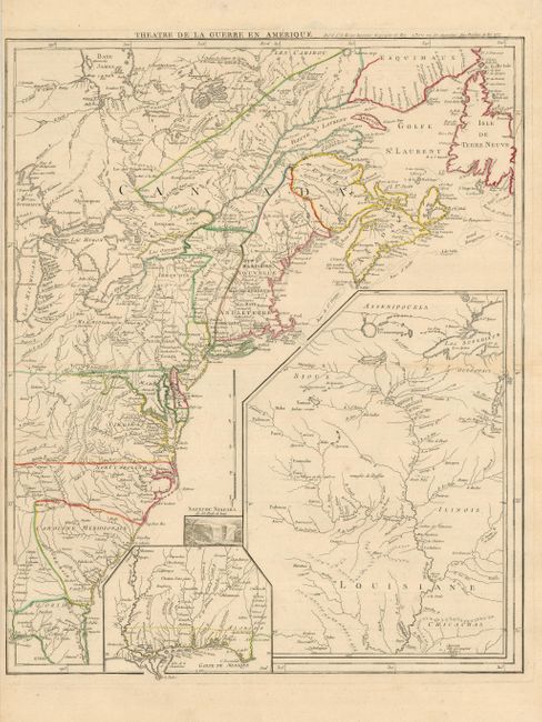
A fine Revolutionary War period map covers the eastern seaboard from northern Florida to the Gulf of St Laurence, and inland to Lake Michigan and James Bay. The sheet is filled with large insets of the Gulf Coast, the Mississippi River valley and a vignette of Niagara Falls. The map details cities, towns, forts, trails, Indian villages and tribal territory, and battlegrounds (both French and Indian War and Revolutionary War). This map was originally drawn in 1755 (with a different title) to illustrate the French and British settlements on the eve of the French and Indian War. At the outbreak of the Revolution, the plate was updated and re-titled.
References: Sellers & Van Ee #154; McCorkle #777.14.
Condition: A
Clean and bright on a sturdy sheet with original outline color and a couple of insignificant spots. Narrow margin at left as issued, but still sufficient for framing.