Subject: Colonial North America
Period: 1755 (dated)
Publication: Nieuwe en Beknopte Hand-Atlas
Color: Hand Color
Size:
17.8 x 14.3 inches
45.2 x 36.3 cm
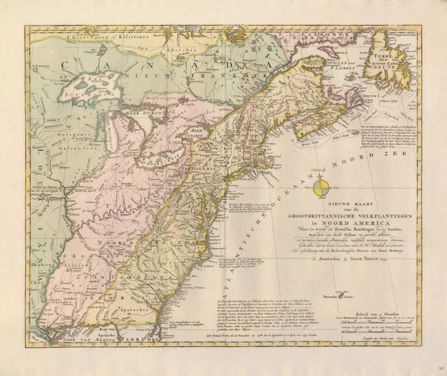
This is a handsome illustration of the region at the beginning of the French and Indian War. It is a very detailed map of the British and French possessions and the disputed region between the Mississippi River and the Appalachian and Allegheny Mountains, which is graphically depicted by the original color and delineated by a dashed line for the French claims and a dotted line for the British claims. The frontier forts of both nations are located, as are colonial settlements and Indian villages. A small compass rose is the only ornamentation. The map was based on information from John Mitchell's great map of North America. Although this map bears the date 1755, it apparently was not published until 1769.
References: McCorkle #755.39 &769.1; Sellers and Van Ee #63.
Condition: A+
A superb example on a strong sheet with original color. The margins have two minor stains at the very edge, well away from the map. This is the atlas edition, printed on strong paper with a single centerfold.