Subject: Colonial North America
Period: 1730 (circa)
Publication: Neuer Atlas
Color: Hand Color
Size:
23 x 19.3 inches
58.4 x 49 cm
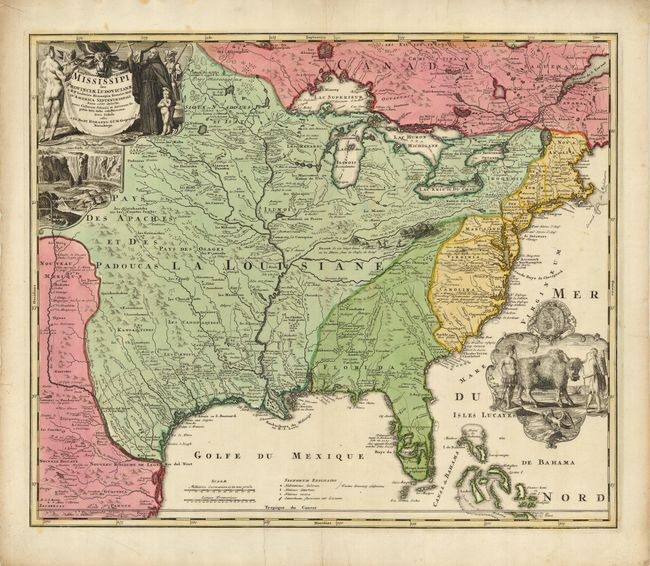
A striking map based on Delisle's landmark map of 1718, but covering a slightly larger area. It focuses on the Mississippi River Valley interior and Great Lakes, also detailing the Gulf Coast region, where the Mission de los Teyas is noted in present-day Texas. The map is splendidly adorned by vignettes of a buffalo and Native Americans in a cartouche filling the Atlantic and a beaver colony at Niagara Falls under the title cartouche. Also depicted in the title cartouche is Father Louis Hennepin who explored the Great Lakes region and claimed to have reached the mouth of the Mississippi. The routes of Hennepin, de Soto and other explorers are traced in the map.
References: Goss (NA) #49; cf Cumming (SE) #170.
Condition: B+
A sound sheet with a good impression and strong original color. The margins have some short tears, with one repaired tear just into the border at the bottom. There are a few light stains in the Lake Erie area and in the margins.