Subject: Indian Ocean
Period: 1851 (dated)
Publication:
Color: Hand Color
Size:
13 x 10.5 inches
33 x 26.7 cm
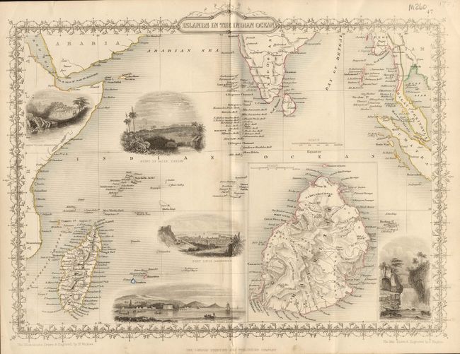
Beautifully engraved map featuring vignette views with delicate decorative borders and titling. The main map is centered on the Indian Ocean and extends from Africa and Madagascar to Sumatra including the southern part of India with numerous small islands named. The vignettes include "Point de Galle - Ceylon," "Port Louis - Mauritius," "North Beach - Prince of Wales Island," and "Falls of the River Roche - Isle of Bourbon." An inset map of the island of Mauritius is very detailed. Illustrations by H. Winkles, the map by J. Rapkin.
References:
Condition: A
One faint crease, else fine.