Subject: Northern Africa
Period: 1578 (circa)
Publication: Tabulae Geographicae Cl: Ptolemei…
Color: Hand Color
Size:
18.3 x 12.6 inches
46.5 x 32 cm
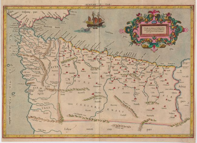
Lovely Ptolemaic map of the northwestern part of Africa, filled with ancient names, including the Straits of Gibraltar, here called the Herculeu fretum. Although he is most renowned today for his map projection and the popularization of the term Atlas for a collection of maps, Gerard Mercator devoted much of his life to his Ptolemaic maps. The maps were beautifully engraved as nearly as possible to their original form from Ptolemy's textual descriptions and embellished with fine cartouches and scenes. This map is decorated with a lovely strapwork cartouche festooned with garlands of fruit and the stipple engraved sea includes a scene of a sea monster and sailing ship.
References: Mickwitz & Miekkavaara (Nordenskiold) #221-12.
Condition: B
A nice impression on a sheet that has had its margins trimmed with just enough left framing. There is a little bit of irregular toning.