Catalog Archive
Auction 120, Lot 655

"A New Map of Present Italy, together with the Adjoyning Islands of Sicily, Sardinia, and Corsica, Shewing Their Principal Divisions…", Wells, Edward
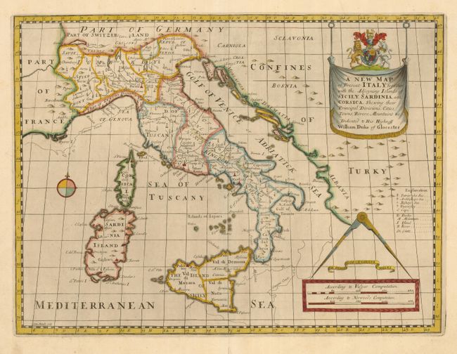
Subject: Italy

Period: 1700 (circa)

Publication: A New Sett of Maps

Color: Hand Color

Size:
19.4 x 14.5 inches
49.3 x 36.8 cm
Download High Resolution Image
(or just click on image to launch the Zoom viewer)

Crisply engraved map of the various states and republics that made up Italy during this period. The maps show pictorial depictions of topographical features, including a flaming Mt. Aetna erupting on Sicily. Wells has included lines sketched along the coastlines, labeled Sanson's Coast that show the variations between this map and Sanson's map of the region. The map is decorated with a drape-style cartouche dedicated to William, Duke of Gloucester, and a scale of miles topped with a large compass. The distance scales are labeled "According to Vulgar Computation" and According to Norwoods Computation."

References:

Condition: A

Lovely impression and color with wide margins. Professional repair on fold separation in bottom margin

Estimate: $275 - $375

Sold for: $250

Closed on 7/18/2007

Archived