Subject: Russia, Novaya Zemlya
Period: 1598 (dated)
Publication:
Color: Black & White
Size:
9.8 x 7 inches
24.9 x 17.8 cm
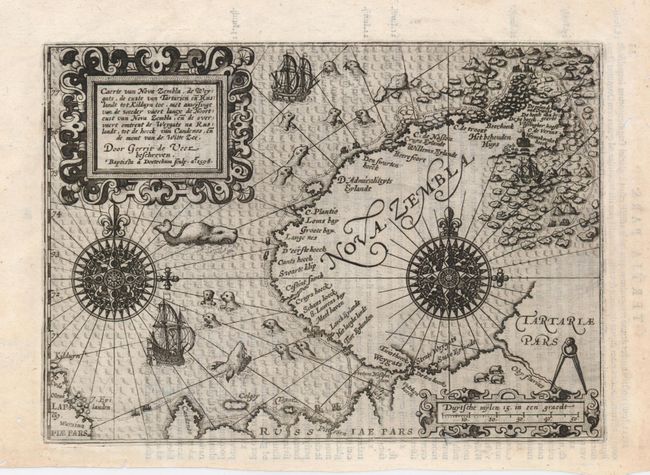
Rare map of the island of Novaya Zemlya drawn directly from the mapping of Gerrit de Veer, who participated in and published an account of Willem Barentsz' expedition of 1596 in search of a Northeast Passage to Asia. The expedition was stranded by ice in June, and they lost both Barentsz and another crewmember to illness. The map shows the route of the ship and the location of the house they built from driftwood called Het Behouden Huys (the Saved House). De Veer was the first person to report the Novaya Zemlya effect, and optical illusion or mirage in which a distorted image of the sun appears to rise above the horizon, when it is actually still 5° below the horizon. This small map busily presents two large compass roses, sailing ships, ice-flows, and abundant sea-life, including walruses, seals, sharks and whales. The island is depicted with only the explored western and northern coastlines. Engraved by Baptista a Doetechum, Latin text on the verso.
References:
Condition: A
Crisp impression with a few marginal worm tracks, not affecting the map.