Subject: Brazil
Period: 1730 (circa)
Publication:
Color: Hand Color
Size:
19.5 x 15 inches
49.5 x 38.1 cm
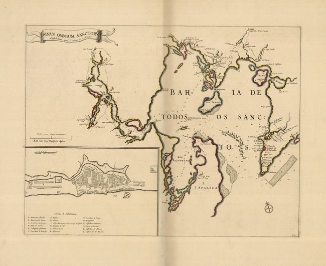
This impressive map of the Baia de Todos os Santos, in northeastern Brazil, is a later edition from Blaeu's plate. The map depicts a large fleet of Dutch ships entering the bay and locates several battle sites. Large inset plan of Civitas S. Salvatoris (San Salvador). Ribbon style title cartouche. The copper plate for this map was among those that survived the fire at the Bleau printing house in 1672. After the death of Johannes Bleau the following year, the remaining stock was sold to other Dutch cartographic publishers including Frederick de Wit, Pierre Mortier, and Schenk and Valck. Many of these maps were included in composite atlases, even as late as 1730.
References:
Condition: A
Margins slightly trimmed, but still very wide.