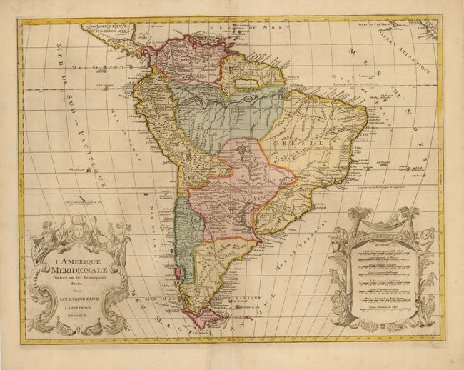
Subject: South America
Period: 1792 (dated)
Publication:
Color: Hand Color
Size:
23.8 x 18.2 inches
60.5 x 46.2 cm
This is a handsome and large map of the continent decorated with elaborate title and scale of miles cartouches balancing the lower portion of the map. The continent is divided into the French, Spanish, Portuguese and Dutch possessions. The fourteen coastal Capitaineries created by the Portuguese are delineated in Brazil. The fictitious Mer de Parime is named along with the mythical Manoa el Dorado on its banks. The course of the Amazon is delineated in a fairly accurate manner, yet it shows the river's source in a fascinating, interlacing maze of waterways. The Rio Paraguay erroneously begins is a lake named Xarayes in the middle of Brazil.
References:
Condition: A
Printed on a sturdy sheet with nice old color. The bottom centerfold is reinforced in margin and there is a light printer's crease at the top right.