Subject: Grenada
Period: 1794 (dated)
Publication: The West-India Atlas…
Color: Hand Color
Size:
24.3 x 18.5 inches
61.7 x 47 cm
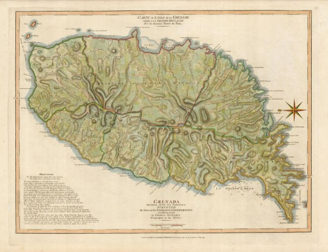
Handsome and hard to find map of the island shows the topography by use of hachure along with roads, towns, hospitals, and plantations. A nota bene to the bottom left describes the attributes of the land and notes the fifty paces along the coast belonging to the King of England. Grenada had passed back and forth between the British and French colonial powers during the 18th century, with France ceding the island to Britain in the 1763 Treaty of Paris. The French regained control during the American battle for independence, and won the island during the 1779 Battle of Grenada. In 1783, the island was ceded back to the British with the Treaty of Versailles. The coastlines are well delineated and include the locations of safe harbor and soundings in the bays. The map has a striking compass rose orienting the map with north to the left. Second French title: Carte de l'Isle de la Grenade cedee a la Grande Bretagne par le Dernier Traite de Paix. This edition published by Laurie & Whittle.
References: MCC 62 (Tooley) #27.
Condition: A
Lovely impression and color with a couple very faint stains in the blank margins, well away from the map.