Catalog Archive
Auction 120, Lot 407

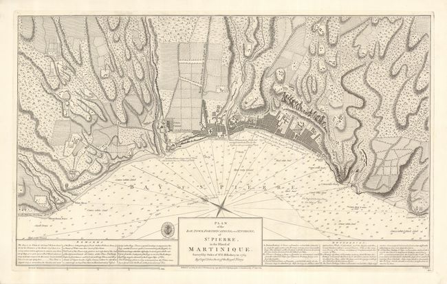
"Plan of the Bay, Town, Fortifications, and Environs, of St. Pierre, in the Island of Martinique. Survey'd by Order of Sr. G.B. Rodney in 1763 by Captn. John Stott of the Royal Navy", British Admiralty

Subject: Martinique

Period: 1814 (dated)

Publication:

Color: Black & White

Size:
25.3 x 15.5 inches
64.3 x 39.4 cm
Download High Resolution Image
(or just click on image to launch the Zoom viewer)

A rare, copper engraved plan with incredible detail, this example shows the terrain, farmland, rivers, roads, and military batteries of the town, while soundings, sand types and important notes are listed in the waters. The seal of the Hydrographical Office appears to the left of the title with a note just below listing the original price of this plan at one shilling. Originally published by Jefferys in Charing Cross, and re-issued by the Hydrographical Office in 1814. Published by Capt. Hurd, Royal Navy Hydrographer to the Admiralty, 8th Sept 1814.

References:

Condition: A

Minor soiling to the corners well away from the image. Nice, wide margins, and a very crisp impression on bright paper.

Estimate: $400 - $500

Sold for: $300

Closed on 7/18/2007

Archived