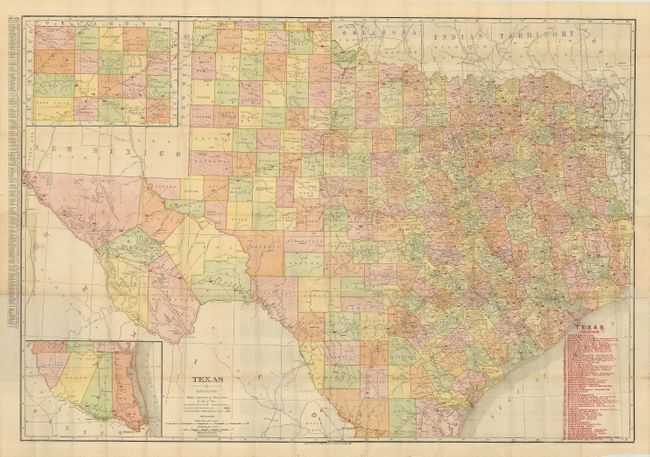
Subject: Texas
Period: 1906 (dated)
Publication:
Color: Printed Color
Size:
37 x 26 inches
94 x 66 cm
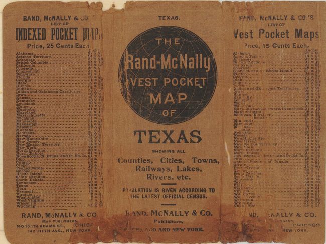
The vest pocket map series features colorful and detailed maps that fold into small paper covers. This map of Texas is rather large for the series, being over one inch thick when folded. The map has an inset of the panhandle region and another detailing the southern tip, showing the area between Brownsville to Nuevo Laredo. Shows all counties, towns and villages, forts, and more. The map lists nearly 70 railroads, and identifies them on the map with red overprinted numbers next to the printed lines. The verso is an extensive index to the state. The map folds into printed wrapper. A large and desirable pocket map.
References:
Condition: B+
The map is bright with full margins. One fold with area of split, well closed on verso with archival tape. The covers are worn and abraded along bottom with some damage.