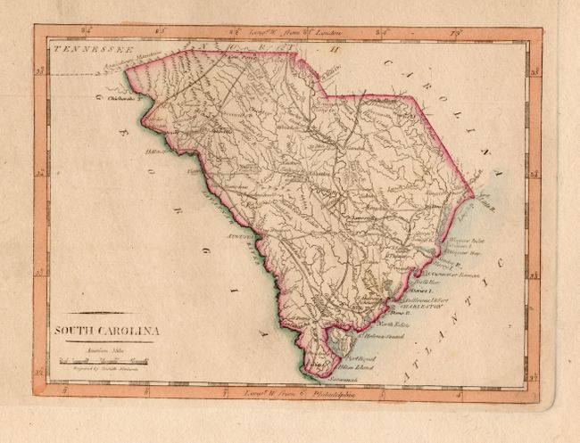
Subject: South Carolina
Period: 1812 (circa)
Publication: American Pocket Atlas
Color: Hand Color
Size:
7.6 x 5.6 inches
19.3 x 14.2 cm
Mathew Carey was a seminal figure in early American publishing; establishing the first publishing firm to specialize in cartography and issuing the first atlas devoted exclusively to American maps. He set up an elaborate cottage system of craftsmen for compiling, engraving, printing, and coloring maps. This practice was emulated by later American cartographic publishers such as John Melish and Henry S. Tanner. The American Atlas concept was also adopted by other publishers in both the United States and Europe.
A delicately engraved map that details topographical features, watershed, towns and villages and the road network. Locates Four Holes Swamp north of Charleston. The distance scale is in American Miles. Engraved by Doolittle.
References: cf Wheat & Brun #603.
Condition: A
Nice example with good coloring and huge margins. Slight wipe of printers ink in blank area to the left and light crease in blank lower margin.